Struggles in Arayat
'Quietly endure, silently suffer and patiently wait.'


Arayat was one of my dream climbs. This was understandable since Arayat, being near my home province, is a prominent mountain. It is a famous mountain in Luzon and is recognized widely in the Philippines. I can actually see this solitary giant even in the place where I live. I always want to climb Arayat but then it took me thirty mountains before I’ve got the chance to finally conquer this mountain. I was in for a surprise because my Mount Arayat traverse climb proved to be one of hardest I had ever done.


Planning an Arayat climb with my hiking group took months. A friend who
is a fellow hiker and is living in Pampanga provided me the contact number of a
tour guide. After getting in touch with the guide, I was dumbstruck upon
learning the cost of getting a tour guide even for a day hike. It was really
expensive compared to other mountains, but I was intent in making all things
possible for an Arayat climb. The cost of registration was just fine and aside
from that, nothing worried me. Even the thought that we are doing a traverse day
hike rather than a back trail to Arayat North Peak, the highest point of the
mountain, didn’t bother me. It was only later that I realized how tedious and challenging
the traverse route was. Still, I was thankful that I considered it instead of
the newly opened Three Peaks Trail which is supposed to commence at the Pinnacle
Peak traversing the South Peak and then finally North Peak. The Three Peaks is
the new trail in Arayat and it was the hardest one according to our guides.


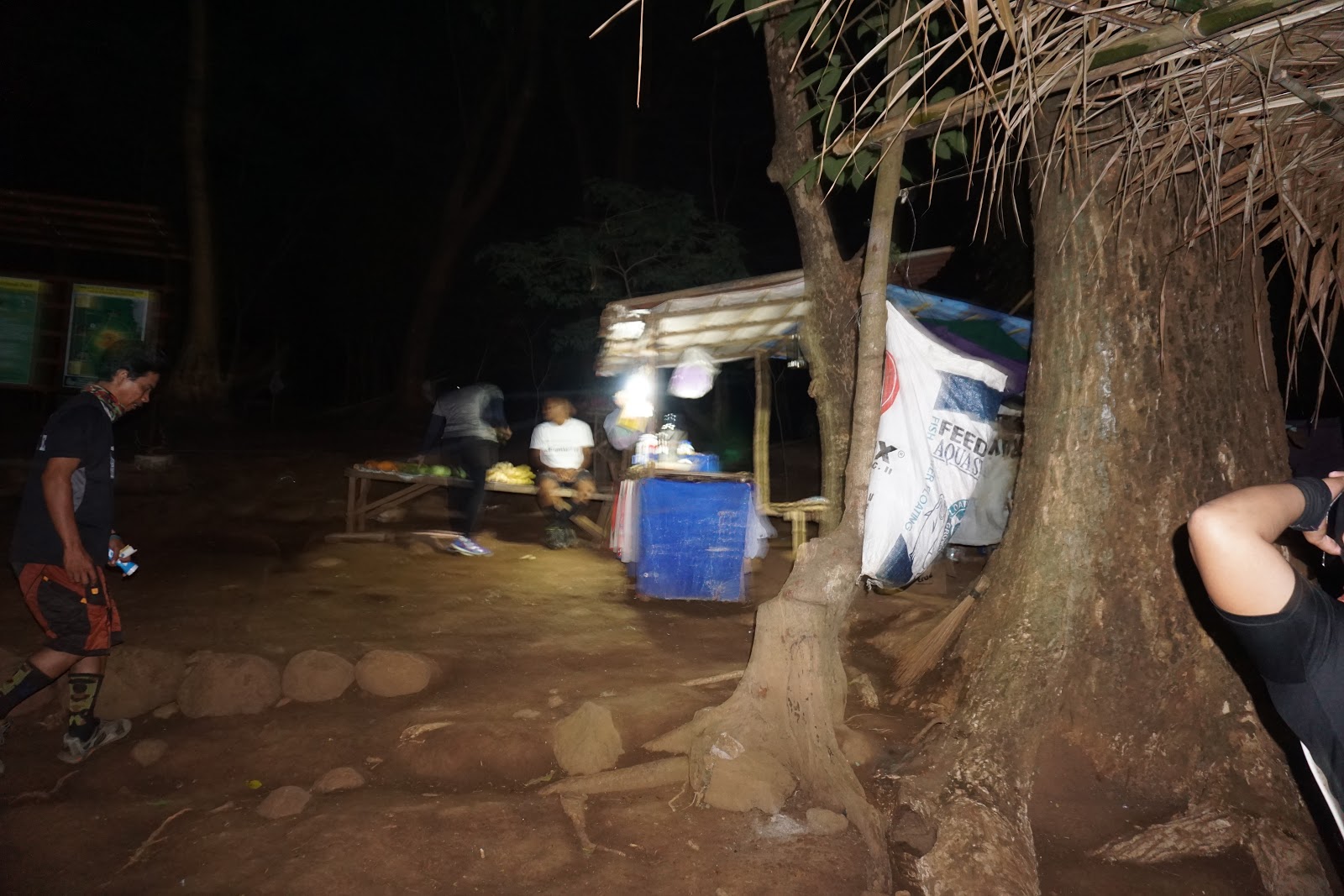
We decided to start our trek early to avoid the intense heat of the day.
Since we didn’t know the way to the jump-off point, our guides volunteered to
meet us at Jollibee in Magalang. We arrived there first and had to wait for
them. When they finally arrived we immediately made our way to the jump-off
point in barangay Ayala in Magalang. We are nearing the jump-off point when we
passed some hikers along the way. Our van drops us a few meters before the
trail head and registration area and we had to walk to get there. It was still
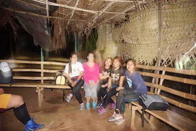
early, so we took few minutes to rest and prepare before we start the trek. We
registered our name and pay the necessary fees before having our group photo
shoot.


We started the trek at exactly five in the morning. Since it was early
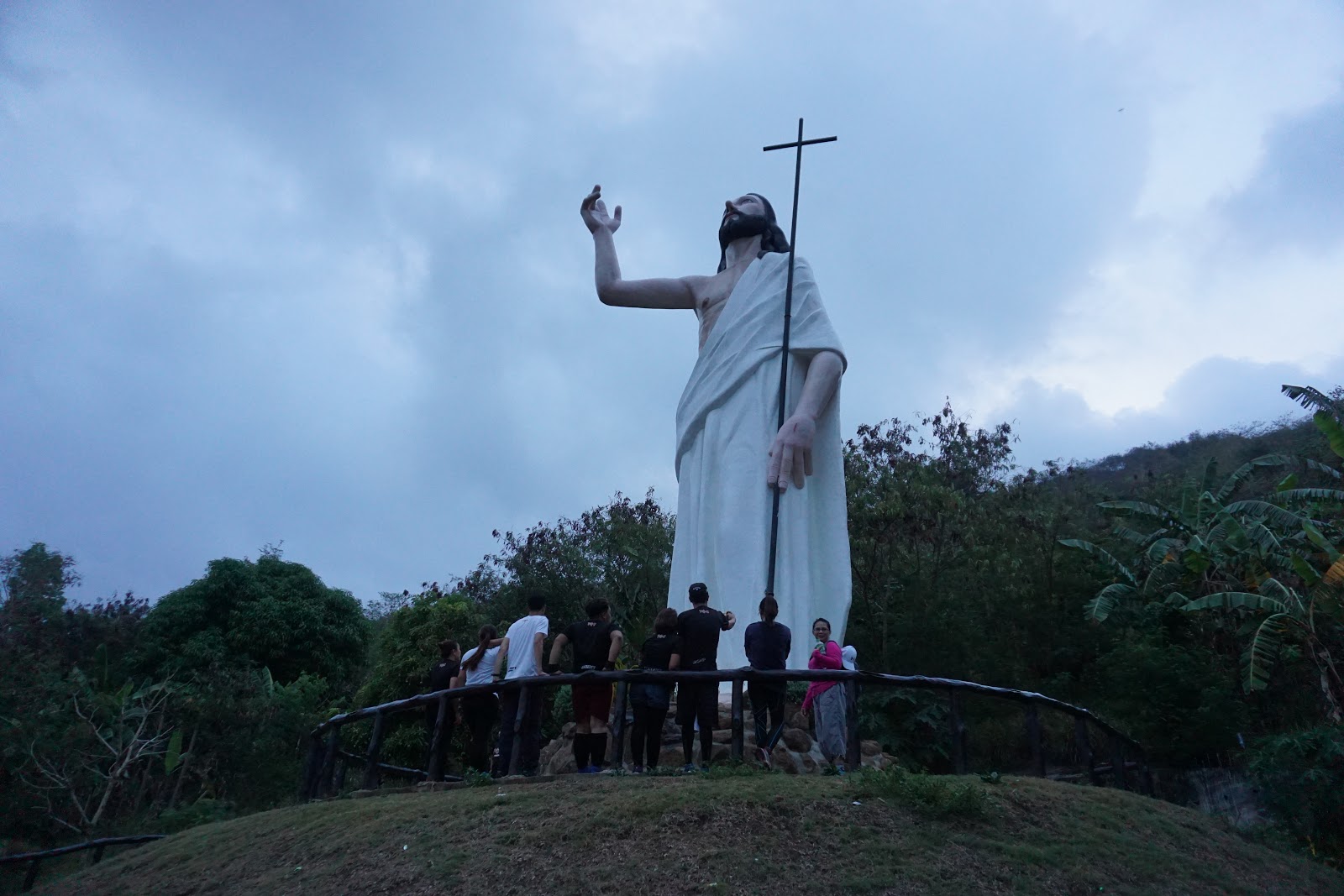
morning, it was still dark. The trail was wide and forested. As we went along
the trail, we saw a huge statue representing the Stations of the Cross. The
initial start of the trek proved to be exhausting since the trail was entirely
assault. Even if it was early morning but the atmosphere in the mountain was
strangely hot. We take a rest when we felt the need for it. Soon after, hikers
started to flock along the trail. There was a huge group who started to
struggle because of the difficulty of the trail. It shocked me when I realized
that conquering Arayat was no easy feat. I was overwhelmed by the experience. Arayat
was mostly forested but the real challenge was the steepness of the trail. Almost
ninety percent of the trail starting from the trail head up to the North Peak
summit was assault. There were some rope segments half way near the summit. The
abundance of huge rocks along the trail also posed struggles to our group.


We were lucky though, that the weather was favorable during our time in
Arayat. It was foggy even after we arrived at the North Peak at around 9 in the
morning. It almost looked like it was going to rain but fortunately it didn’t
although at some point we experienced a mild drizzle. We waited for the rest of
the group at a makeshift hut located at the summit. Other hikers also started
to arrive at the summit.


When the rest of the group arrived, we decided to have our lunch. It was
still early but we wanted to take advantage of our time at the summit. We actually
spent two hours at the North Peak since one member of our group had a fever and
had to rest and recuperate. We were with other groups in the summit. Some of
them were doing the back trail while some were doing traverse like us. After 2,
hours we decided to do our group and individual photo shoot and then we
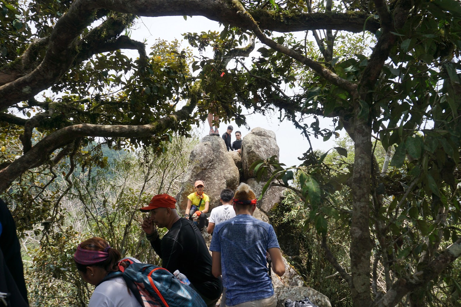
immediately proceeded to ‘Haring Bato’, which was situated between the North
and South Peaks.


The descent was challenging with the presence of some rope segments
again. The trail of the mossy forest was narrow. There are parts where you need
to hold on to something to ascend or descend. It was a struggle maneuvering the
trail to ‘Haring Bato’. We arrived there after more than 30 minutes. There was
a long queue of hikers lining up for some photos at the rock formation, so we
had to wait in one corner for our turn. It took us some time at ‘Haring Bato’
waiting. When the other group was done and it was our turn, we simply had our
individual photo. Some of us didn’t have the guts to scale the rock formation.


To make our way to the South Peak, we made another steep and challenging
descent. The descent was another struggle for the group, even with the presence
of a rope and the instructions of our guides. After we individually made it
safe down we continued our trek to the South Peak. The trail was the same and
with one last rope segment we arrived at the South Peak.
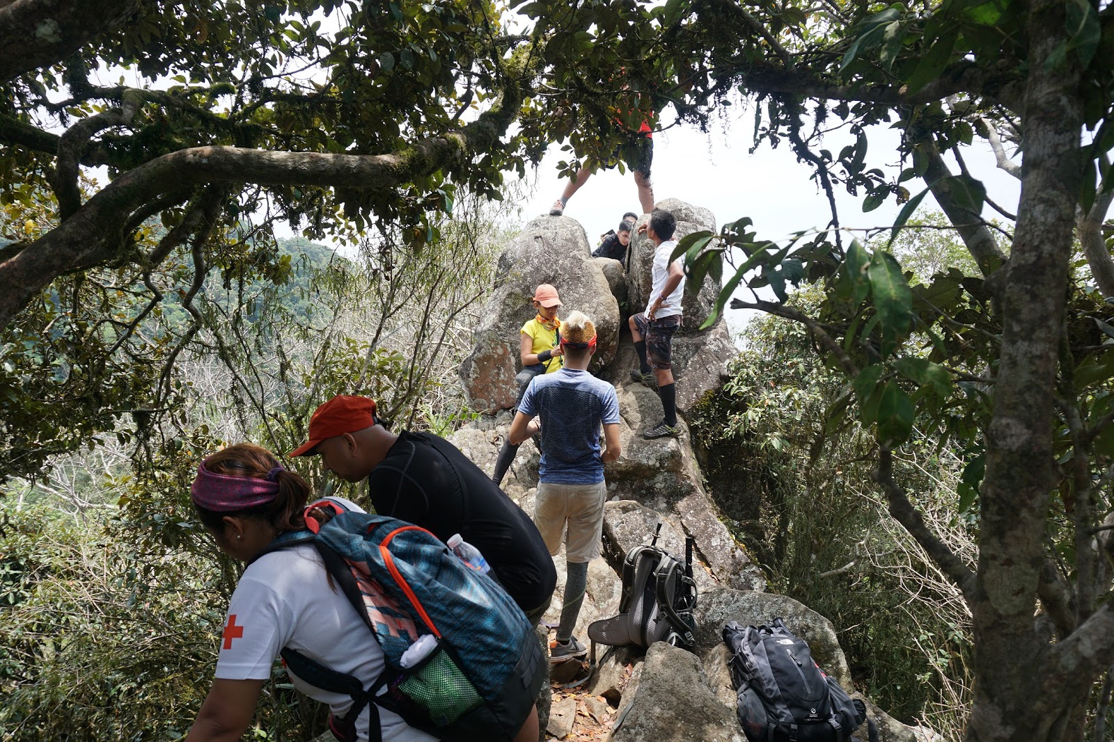


The same group we met at ‘Haring Bato’ was again having their photo
shoot at the South Peak so we had to wait for our turn. The space at the South Peak
where hikers usually took their photos can only accommodate five persons so we
had to wait for the other group to finish. When our time came we proceeded to
the peak. We had to divide the group so it was the ladies’ turn first and then followed
by the men.


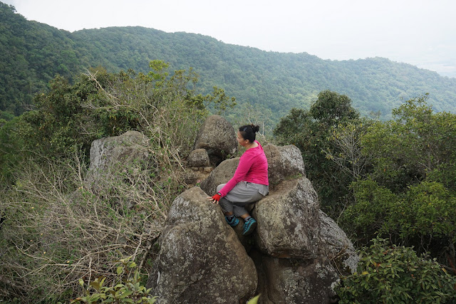
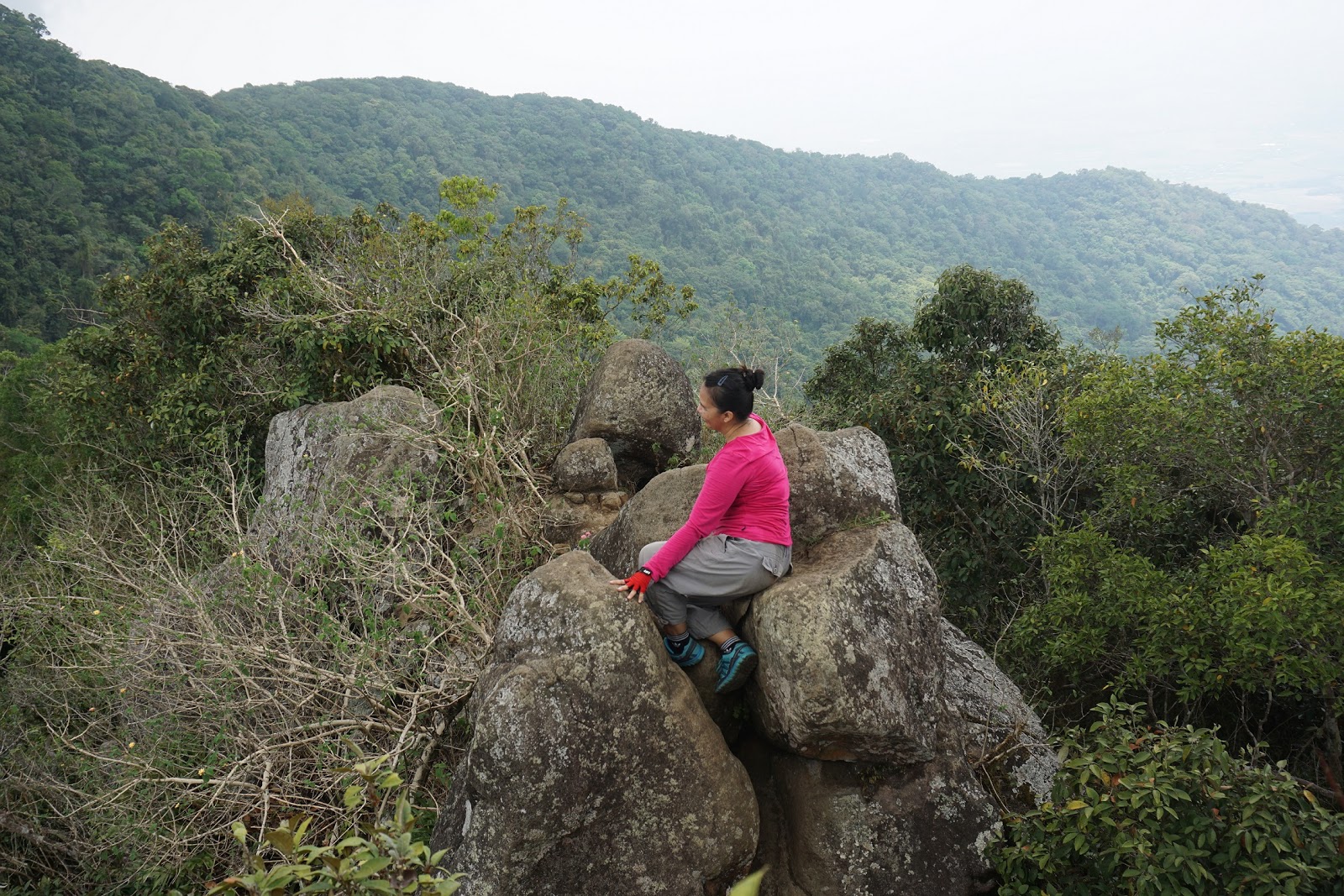
The South Peak is adjacent to the Pinnacle Peak. From the South Peak you
can see the vast Pampanga and Nueva Ecija landscape, including the Pampanga River.
It was still foggy at that time and the view was not that clear and it was unremarkable.
After our time at the South Peak, we decided to make our way down. The traverse
route culminates at barangay Juan Bano in Arayat. Our descent from South Peak
to the Ranger Station took more than 3 hours, of which half of the trail was
steep and rocky and the rest on flat and open terrain.


Upon arriving at the Ranger Station in barangay Juan Bano, we had to
register and pay again. After all in the group arrived, we changed our clothes.
There was no available comfort room and water in the Ranger Station. Thus, we
left the place fully exhausted and feeling sticky and smelly. The climb tested
both our physical and mental capabilities.


Doing an Arayat traverse day hike was really exhausting. It took us more
than 12 hours to complete the trek. Arayat was a major climb for nothing. Its
trail proved to be taxing and required physical skills. All the rappelling and
navigating the rocky and mossy forest was nerve wracking. It almost looked like
you’re doing acrobatics while making your way to the two peaks as well as on the
way down. For first timers, doing an Arayat traverse climb would be challenging
especially if you’ll be doing it in one day. I recommend a back trail along
north peak for beginners; but in case you still want to pursue a traverse, it’s
better do it in two days’ time. Doing an overnight hike was a good option and I
recommend it to those who don’t want to start the trek early and want to have
plenty of time to rest while navigating the arduous trail.

Arayat trail almost looks like Makiling’s trail. Both mountains are
thickly forested, with both being National Parks and protected areas. Almost
half of Arayat’s trail was mossy forest. I found Arayat more difficult and
technical than Makiling. Arayat’s rope segments were also more challenging than
Natib’s five rope segments. The descent from the south peak down to the ranger
station was also exhausting. It will drain all your energy (and your water bottle).

Despite the body pain I experienced after the hike and the even the high
cost of guide fees I was still satisfied with my Arayat’s experience. There was
no regret at all. It was a struggle conquering this mountain but it did not
disappoint me. All of our hardwork was worth it. Next year I am planning to go
back there and probably do a 3 Peaks traverse hike. I am looking forward to that
day and I will come then fully prepared. I will arm myself with lots of
patience, perseverance and lots of guts.


Mt. Arayat Traverse Dayhike
April 30, 2017
Brgy. Ayala, Magalang, Pampanga - Brgy. Juan Bano, Arayat, Pampanga
ITINERARY:
02:00 AM – Assembly at McDonalds-Motorway
03:00 AM – ETD McDonalds-Motorway
04:15 AM – ETA Brgy. Ayala, Magalang/Register
05:00 AM – Start trek
09:00 AM – ETA North Peak/Lunch/Photo op
11:00 AM – Resume trek to Haring Bato
11:45 AM – ETA Haring Bato/Photo op
01:00 PM – Resume trek to South Peak
01:45 PM – ETA South Peak/Photo op
02:30 PM – Start descent
05:30 PM – ETA Brgy. Juan Bano, Arayat/Register/Tidy up
06:30 PM – ETD to Tarlac
08:00 PM – ETA Tarlac City
CONTACT INFORMATION:
Mr. Marlon M. Nucup
Tour Guide
Tour Guide
Contact no.: 0909-461-9694
Facebook: https://www.facebook.com/marlon.nucup


Comments
Post a Comment